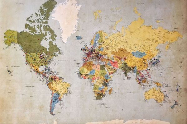
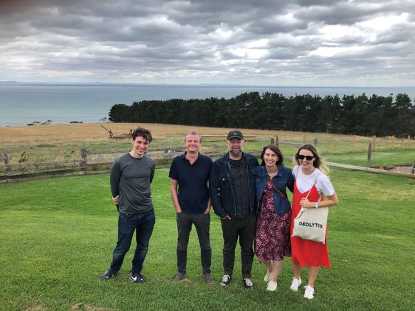
Our Team Featured Geolytix: An International Location Intelligence Company From start up to scale up, Geolytix has worked with some of the biggest retail, leisure, and restaurant brands in more than 55 countries over the last 10 years.
GeoData Bridging the gap between Censuses The UK Census is conducted every 10 years, so how do we bridge the gap between to get granular population and household estimates and forecasts?
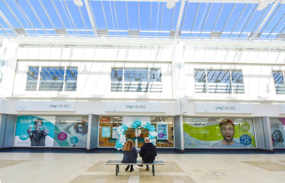
Market Visits Filling the gaps with {mydentist} How Europe’s biggest dental provider uses GEOLYTIX MAPP to manage their network of practices and target the most appropriate opportunities for growth.
Team Thoughts LondonShuffle Six years ago we had a team social to a newly opened Shuffleboard club called LondonShuffle. We were delighted to support them recently with some location data and analysis.
GeoData 10 new GeoData packs in 10 countries Not only are we celebrating 10 years of Geolytix this month we have been busy created new GeoData for 10 countries.
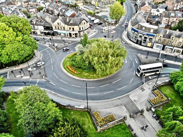
GeoData From South Korea to the UK : Understanding 'how busy is this road?' We introduce you to one of our most ambitious data networks we have created - a modelled value count for every major road in the county of operation; we started with South Korea.
GeoData Has Yorkshire bounced back? The impact of the opening of outdoor seating on mobility levels in Yorkshire, compared to pre-COVID (2019) and lockdown (January - April 2021).
Team Thoughts Office Place Recovery Through the last 15 months, we have been using mobility data and applying it within 8,000 of our Retail Place boundaries to produce a weekly read on activity levels across the UK.
Team Thoughts London has bounced back The impact of the opening of outdoor seating on mobility levels in London, compared to pre-COVID (2019) and lockdown (January-April 2021)
GeoData Modelled Traffic Volumes - a new product in our Road & Network data pack Our new product in the Road & Network data pack - Modelled Traffic Volumes, answers the question "how busy is this road?"
Open Data Featured Geolytix open Supermarket Retail Points - 20th Edition The 20th version of Geolytix’s open data set; Retail Points, has now been released.
GeoData Featured Global Retail Places Retail Places identify areas where potential customers are attracted to interact with a retail environment. Retail Venues sit within these to specifically define a concentration of retail within a retail place.
GeoData Will the most walked path be the online high-street in 2021? Covid-19 and lockdowns in particular have affected how the UK is shopping, predominately a surge in online shopping. Once lockdown is lifted, will we be itching to get back to the high-street or will online shopping continue to rise in popularity?
GeoData Featured Life After Lockdown Anecdotally, town and city centres have been busy since England Lockdown 2 ended last Wednesday. We’ve been busy processing up mobility data from Saturday to see what it tells us about the 18,000 Retail Places we monitor.
GeoData Featured Did Somebody Say…It’s Beginning to Look a Lot Like Christmas… Wednesday marked the end of England’s four-week Lockdown II. Many retailers will now be looking to salvage what they can following a tumultuous year. The run-up to Christmas is always a condensed & critical period but in 2020 this is exacerbated. So, what can we expect during these next three weeks?
GeoData Featured The Wales Firebreak The Wales Firebreak that came into effect on 23rd October attracted a great deal of media attention last week, with photographs of cordoned off ‘non-essential’ aisles a regular feature. But has the Wales Firebreak worked in terms of reducing activity?
Team Thoughts Featured Consistency Across Borders As retailers increasingly take a more regional or even global view of multi-channel strategy, the importance of defining and applying a consistent data and analytical approach across borders has also increased.
Our Team Featured Historic England - High Street Heritage Action Zones How can you use data to identify ‘similar’ locations? For retailers, looking for areas similar to those with high performing stores, this may be a simple enough task. Counts of surrounding population, competition and demographic data lend themselves well to similarity modelling.
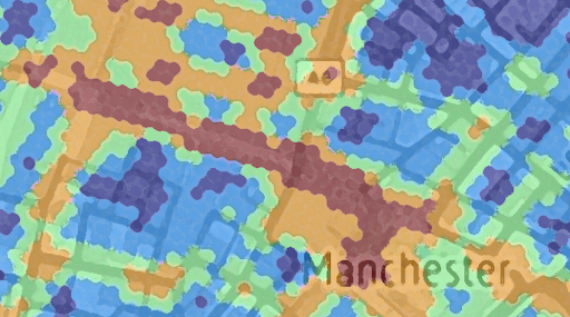
GeoData Featured Geolytix Town & Suburb Boundaries A common remark we get from clients is their surprise that there is no official published source of suburb/town/city boundary. 8 years ago, Geolytix’s created the Town and Suburb data pack.
GeoData Featured Geolytix Seamless Town & Suburb Boundaries A common remark we get from clients is their surprise that there is no official published source of suburb/town/city boundary. 8 years ago, the first iteration of Geolytix’s Seamless Town and Suburb were created.
GeoData Featured How can data help our tourist towns recover? We’ve been pondering this question at Geolytix. Here in our local state of Victoria, Australia, our tourist towns have been hit by the double whammy of horrific bushfires followed by the Covid-19 Pandemic.
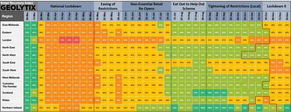
Mobility Featured PRESS RELEASE: Geolytix Retail Recovery Index There seems to be a broad consensus on top-level recovery rates in the UK as lockdown eases. But every city, town, village, shopping centre, retail park and local parade has its own story.
GeoData Featured Retail Recovery - Que Sera Sera? We’re often asked what a good level of forecast accuracy looks like. The answer is always: it depends. Some things are hard to forecast. Really hard. Even harder than convenience store turnover. Like, will things ever return to normal?
GeoData Geolytix UK Postal "For speed and certainty always use a postal district number on your letters and notepaper"
GeoData Geolytix UK : Retail Place Boundaries Geolytix Retail Places is the ultimate product for profiling, describing and modelling UK retail. The data set currently has 21,942 identified areas of retail reaching from City Centres to parades of 3 units. It continues to be a popular and established product since it's very first release in 2012.